படிமம்:Rennel map 1799.png

இந்த முன்னோட்டத்தின் அளவு: 746 × 600 படப்புள்ளிகள் . மற்ற பிரிதிறன்கள்: 299 × 240 படப்புள்ளிகள் | 597 × 480 படப்புள்ளிகள் | 955 × 768 படப்புள்ளிகள் | 1,273 × 1,024 படப்புள்ளிகள் | 1,318 × 1,060 படப்புள்ளிகள் .
மூலக்கோப்பு (1,318 × 1,060 படவணுக்கள், கோப்பின் அளவு: 335 KB, MIME வகை: image/png)
| இது விக்கிமீடியா பொதுக்கோப்பகத்தில் இருக்கும் ஒரு கோப்பாகும். இக்கோப்பைக் குறித்து அங்கே காணப்படும் படிம விளக்கப் பக்கத்தை இங்கே கீழே காணலாம்.
|
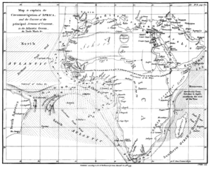
| விளக்கம் | Map of the currents in the Atlantic and Indian Ocean | ||||
| நாள் | |||||
| மூலம் | "The geographical system of herodotus ..." by James Rennell, London 01. January 1800 | ||||
| ஆசிரியர் | James Rennell | ||||
| அனுமதி (இக்கோப்பை மீண்டும் பயன்படுத்துதல்) |
|
||||
கோப்பின் வரலாறு
குறித்த நேரத்தில் இருந்த படிமத்தைப் பார்க்க அந்நேரத்தின் மீது சொடுக்கவும்.
| நாள்/நேரம் | நகம் அளவு சிறுபடம் | அளவுகள் | பயனர் | கருத்து | |
|---|---|---|---|---|---|
| தற்போதைய | 15:07, 13 பெப்பிரவரி 2018 | | 1,318 × 1,060 (335 KB) | Shyamal | Contrast |
| 17:28, 4 ஆகத்து 2005 |  | 1,318 × 1,060 (4.01 MB) | Kl833x9~commonswiki | Map of the currents in the Atlantic and Indian Ocean Created by James Rennell 1799 Source: Copy from Book "The geographical system of herodotus ..." by James Rennell, London 01. January 1800 {{PD}} |
கோப்பு பயன்பாடு
பின்வரும் 2 பக்கங்கள் இணைப்பு இப் படிமத்துக்கு இணைக்கபட்டுள்ளது(ளன):
கோப்பின் முழுமையான பயன்பாடு
கீழ்கண்ட மற்ற விக்கிகள் இந்த கோப்பை பயன்படுத்துகின்றன:
- ar.wiki.x.io-திட்டத்தில் இதன் பயன்பாடு
- ary.wiki.x.io-திட்டத்தில் இதன் பயன்பாடு
- bn.wiki.x.io-திட்டத்தில் இதன் பயன்பாடு
- br.wiki.x.io-திட்டத்தில் இதன் பயன்பாடு
- ca.wiki.x.io-திட்டத்தில் இதன் பயன்பாடு
- da.wiki.x.io-திட்டத்தில் இதன் பயன்பாடு
- da.wikibooks.org-திட்டத்தில் இதன் பயன்பாடு
- de.wiki.x.io-திட்டத்தில் இதன் பயன்பாடு
- en.wiki.x.io-திட்டத்தில் இதன் பயன்பாடு
- es.wiki.x.io-திட்டத்தில் இதன் பயன்பாடு
- fa.wiki.x.io-திட்டத்தில் இதன் பயன்பாடு
- fa.wikibooks.org-திட்டத்தில் இதன் பயன்பாடு
- hif.wiki.x.io-திட்டத்தில் இதன் பயன்பாடு
- hi.wiki.x.io-திட்டத்தில் இதன் பயன்பாடு
- id.wiki.x.io-திட்டத்தில் இதன் பயன்பாடு
- ja.wiki.x.io-திட்டத்தில் இதன் பயன்பாடு
- mk.wiki.x.io-திட்டத்தில் இதன் பயன்பாடு
- nl.wiki.x.io-திட்டத்தில் இதன் பயன்பாடு
- pnb.wiki.x.io-திட்டத்தில் இதன் பயன்பாடு
- sd.wiki.x.io-திட்டத்தில் இதன் பயன்பாடு
- tr.wiki.x.io-திட்டத்தில் இதன் பயன்பாடு
- ur.wiki.x.io-திட்டத்தில் இதன் பயன்பாடு
- www.wikidata.org-திட்டத்தில் இதன் பயன்பாடு